View dan Edit File AutoCad Menggunakan Web Browser


Autocad wsPreviously I've posted about Project Butterfly, a service where AutoCAD users can view and edit AutoCAD files (DWG / DXF) online via the Web browser. Project Butterfly is now renamed AutoCAD WAS with additional apps for remote viewing and editing on the Android and iPhone smartphones.
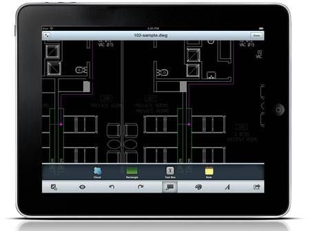

AutoCAD WS on Android

AutoCAD WAS available basic features such as drawing / editing / annotation tools and also supports layers. Currently you do not create new files in this service, because it functions only to view and edit it.

However, you can create a DWG file / DXF using CAD software free LibreCAD / CADuntu to then upload it into AutoCAD WAS. Or you can also save as a file you've uploaded previously, delete all the existing features and layers. That way you have a blank canvas to create a new drawing.

AutoCAD WAS already integrated with Google Maps. With Google Maps as the background of CAD drawings, users can collaborate between drawing / design with a map / satellite image. User can share, review, co-edit, or publish a link or image map that the user selected.

WAS supports AutoCAD DXF files / DWG with geoference, but do not have features to make changes to the projection coordinate system. If you want pictures you can overlay it with Google Maps that are already available in the service, then your image should have a geographic projection system. But if your coordinate system is different from the existing maps on Google Maps, you can use a tool to adjust Place Drawing a map on Google Maps.

WAS AutoCAD can be used by anyone with first register there. Here is a video that shows the use of AutoCAD WAS in a tablet with the Android platform.

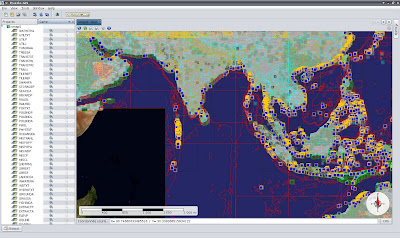
Know Your Puzzle-GIS: GIS Software Free Java-Based

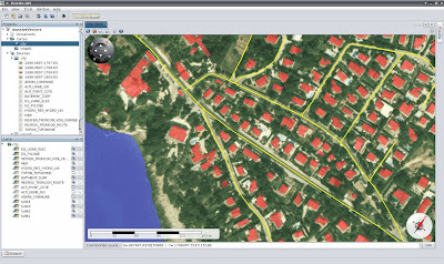
Java Puzzle-GIS is Geographic Information Systems (GIS) development platform that is built using the NetBeans Platform. The main purpose built Puzzle-GIS is the availability of free GIS software that can produce spatial data as well as a competitive tool as an alternative to other commercial GIS software.


Puzzle-GIS is divided into two versions, namely User and Developer. For User version, users can use the GIS software that can be running on all these operating systems are multi-screen and multi project simultaneously. User interface high quality and ease of installation process becomes important points in Puzzle-GIS.


Untuk versi Developer, seperti yang terdapat di website-nya, keunggulan Puzzle-GIS diantaranya :
  1. 100% Java (at least we try to be)
  2. Java Web Start supported
  3. One version for all operating systems
  4. No operating system limitation (just need a JVM 1.6 or more)
  5. No installation needed (because of Java Web Start)
  6. Built on NetBeans Platform for a professional architecture
  7. Built on GeoToolKit, a high quality GIS library

You can try the Puzzle-GIS which is currently available in version 0.7

How the iPhone Knowing your location?

Allegations that the iPhone / iPad has been tracking and recording the location-based data on mobile

devices
has been argued by Apple. Bitten apple logo company stated that it was just a bug that occurs in a location-based software that has been storing the user's location without ever automatically delete it after so long. Then how exactly the iPhone know your location?

iphone white
iPhone and iPad also has embedded technology in Assisted-Global Positioning System (A-GPS) which is a refinement of the GPS satellite positioning as in the hemisphere. Advanced Positioning Method contained in A-GPS is a positioning method of the most high accuracy compared with other position detection method. so that A-GPS is much more efficient and effective in accessing information from the satellite because it does not need tolook for the data one by one from the existing 24 satellites ,but A -GPSalready knows the target ( satellite),which are required or intended . Furthermore, A-GPS is a service that combines GPS and GSM systems (Global System for Mobile Communications).

Apple and Google also through its Android also uses Wi-Fi positioning technology. This technology is the answer to a better location accuracy in urban and indoor closure_uid_p2n8dn="2525" title="Klik untuk terjemahan alternatif">areas, because of tall buildings and roofs of buildings blocking the GPS to get a satellite transmission, thereby reducing the accuracy and speed of determination of location. As is known, the GPS may take up to about 10-15 minutes to get a satellite transmission at the first GPS enabled, and even then depending on its location, whether in open areas or not.

Wi-Fi positioning technology will work by logging on to the points Wi-Fi hotspots and cell phone tower near the gadget. For information, phone towers and Wi-Fi access point has a geographic location in the device when installed. The page on Wikipedia here might give an idea of ​​how the technology Wi-Fi or Wi-Fi positioning Trilateration.

Apple has been using Wi-Fi positioning technology that began to be used in IOS 4 of the companies that already have a database of Wi-Fi access points worldwide, Skyhook [http://www.skyhookwireless.com/howitworks/coverage.php].


iphone maps

With one or both technologies, the iPhone user's location / iPad quickly and precisely to find out his position every time you open the Maps application which is marked with a blue circle. When the circle appears large, in fact the GPS / A-GPS was working and collecting other sources, both from mobile phone towers and Wi-Fi hotspots to get the most precise location. When the location is believed by the software as an appropriate location, bright blue color with a small size indicates the exact location.

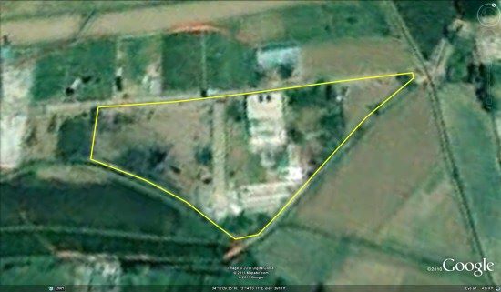
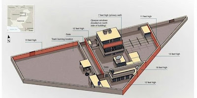
The location of Osama Bin Laden's Mansion in Google Earth

The shooting Osama Bin Laden has become headline news around the world. Osama was reported shot in a mansion, stately building in Abbottabad, a city that is relatively quiet and cool in northern Pakistan. You can view the location of Osama Bin Laden's mansion in Google Earth by downloading this KML file.


Knowing the coordinates of a Location

google maps
The coordinates of a particular location on the surface of the earth, it later began to realize more and more asked how do I get it. There are simply curious, but others were needed for plotting the location of such surveys. A financial intermediary in the same building where I work now, equip surveyornya with GPS for plotting the location of candidate costumernya. But you know, that Google Maps provides the tools to determine the coordinates of a location with an easier way? There are several ways to get the coordinates of the location of an object on the surface of the earth by using Google Maps. In this post I present 5 ways, namely:

How 1: Use the Send menu or Links

Click on Send or link on the right of the map. When clicked on Send, then Message body will have the value Latitude Longitude at about line end (see picture).
send

Method 2: Use Hacking with Javascipt
To determine the coordinates of a location on Google Maps, you can also use a line of JavaScript that typed in the address bar of your browser. Previous confirm the location or object you want to know koordinatnnya are in the middle of the display Google Maps. By default, if you do a search using the Search Form are available, the results of these searches will be in the middle of the display of Google Maps. Next, type the following code in the address bar of your browser:

javascript: void (prompt (", gApplication.getMap (). getCenter ()));

Oalaa ... A popup window will appear with the indicated value of latitude and longitude of the location in the center Google Maps! This tip from Lifehacker.


javascript

How 3: Installing Google Map Add-Ons

You can also install an add-on for Google Maps that works to provide ease of obtaining the coordinates that you cari.Add-on that the intent is PositionFinder. Its use is very easy. To install simply click the Add it to Maps button

.positionfinder
How 4: Utilizing the Menu "Directions from here"

Following manner easier than ever, right click on the location you specify, and select "Directions from here". A pop up box will appear with the name Get Directions. There are values


koorinat location from the location that you specified earlier.get directions
How 5: By Using Google Earth

We encourage you to take advantage of Google Earth, Google Earth because you do not have to do the 4 ways above to find out the coordinates of a location, because by using Google Earth more easily and also supports the UTM projection system. Just not have to install first to use it ...