Political geography

Political geography
Political geography is the study of the relation between life and political activity with the natural conditions of a State. Aspects contained in the Political Geography and Geography itself is such a wide geographical elements, the shape of the region, climate, resources and population.

a. According to Taylor 2000:783
Political Geography (political geography) who stressed that territorial interpreted as a fundamental relationship between the sovereignty of the country with a national homeland is located in the heart of the legitimacy and practice of modern nations. Where the results are analyzes of the region, with a space power focused on the state-centered
http://baehaqiarif.files.wordpress.com/2009/12/geografi.pdf

b. According to Friedrich Ratzel
Political geography emphasizes the connection between geographic physical factors with race - race at each - each country and its form of government ditentkan by nature. Understand the physical determinist.
Biological, Sri & Yani, Ahmad. , 2007. Political geography. New York: PT Refika Aditama

c. According to Otto Maul
Political geography is the doctrine of the landscape as a space of political life where the life of the country took place.
Hermawan, Iwan. , 2009. Geography An Introduction. New Delhi: Private Publishing

d. According to Richard Hennig
Geopolitics is a doctrine of power - political power in relation to the earth and its application in the future relation of the results obtained from studies conducted by the Political Geography.
Hermawan, Iwan. , 2009. Geography An Introduction. New Delhi: Private Publishing

e. According Hashofer
Administrative sciences in collaboration with territorial geography by taking into account the data to examine the formation of the country and its contents by the existing political power struggle. Geopolitics also pay attention to symptoms - symptoms of space activities in the political struggles within and in the arrangement.

Benefits S I G

The advantages of GIS:

Very efficient for a good map layers.
Quick to check and update.
Attribute data and maps easily manipulated by the sig.
Between the interactive map and the computer is in sig
does not require space to store the data it is most efficient for your time and place.
It easier to display the data kereana not have such a pile tympakan menncari eefisien map.
Capable of processing multiple data quickly and precisely with excellent quality as well.


Examples of the use of GIS:
Various symptoms in the present dpat geosphere quickly and accurately presented and bnyak manifold that can provide benefits for life. Therefore, information systems geogarafi dpat utilized in various fields:
Natural resources, including inventory, management of natural resources, kesesuan land for agriculture, plantations, Forestry, land use pernecaan tat, analaisis potential risk areas and the sea.
Areas of planning, including regional planning, settlement planning and site planning industry transmigrants
Arranging the data fields include the principal residence, penuediaan ifnormasi Sensu socioeconomic, election information systems and other
The military fields, including the provision of spatial data for the analysis of routes, logostik, war equipment and the tools to the needs of war and other games.
Education, including determining the location of education, information systems education / academic and other
GIS easily produce thematic maps
GIS can be split between the presentation and database
SIG has the ability to describe the elements that exist on the surface of the earth into a spatial data layer or coverage
GIS is very helpful work closely with the field of spatial and kaitanya geoinformatika.

Benefits of GIS:
Sig can provide geographical information completely and accurately.
Can make a decision on the issue of development.
Supporting the development plan ..
Monitoring of coast and sea.
Information potential of the village.
emantauan land use.
Transportation Sector: This function is used for large and medium-scale maps and spatial analysis, especially for transit route planning management, pengirimsn technicians, service analysis, marketing management and so on.
Mapping of natural resources

UNDERSTANDING AND FAR SENSING SYSTEMS GEOGRAPHY

A. Definition of Remote Sensing (Remote Sensing):
Here are the Senses much sense according to some experts
· Remote sensing (remote sensing), namely the use of radiation sensors record images elektromagnetikuntuk Earth's environment that can be interpreted sehinggamenghasilkan useful information (Curran, 1985).
· Remote Sensing (remote sensing) is the science and art of obtaining information about an object area, or phenomenon through the analysis of data obtained with an instrument without direct contact with the object, area, or phenomenon that were examined (Lillesand and Kiefer, 1998)
· Everett and Simonett (1976): Remote sensing is a science, because there is a certain systematic order to analyze the information from the earth's surface, this knowledge must be coordinated with several other scientific experts such as geology, soil, urban, and so forth.
· Remote sensing (remote sensing), which is a measurement or acquisition of data padaobjek on the surface of the earth from a satellite or other instrument in for much of the object yangdiindera (Colwell, 1984). Aerial photographs, satellite imagery and radar imagery is beberapabentuk remote sensing.
· Remote sensing (remote sensing), the science to get information about the Earth's surface such as land and water of the image obtained from a distance (Campbell, 1987). It is usually associated with the measurement of reflectance or emission of electromagnetic waves from an object.
· Remote sensing (remote sensing), namely, science and technology in the art of obtaining information about objects or phenomena in the (near) surface of the earth through the medium of recording objects or phenomena that harness energy from electromagnetic waves and achieve results in the form of image recording. (personal description)
2. Basic concepts of Remote Sensing (Remote Sensing)
The basic concept of remote sensing consists of several components including sources of energy, atmosphere, staff interaction with objects in the earth's surface, sensor, data processing system, and a variety of data usage
3. Benefits of Remote Sensing of the various disciplines:

A. FIELD OF FORESTRY
Forestry sector with respect to forest management for timber, including timber harvesting planning, monitoring, logging and reforestation, wildlife management and enumeration, inventory and monitoring of forest resources, recreation, and fire control. The physical condition of the forest is very susceptible to fire hazards is the use of infrared imagery would be very helpful in providing data and information in the context of continuous monitoring of temperature change with an adequate geographical aspects of the implementation on the ground that can be done very easily and quickly.
B. USE OF LAND
Inventory of land use is important to know whether the mapping of land by human activities in accordance with the potential or carrying capacity. Appropriate land use achieves good results, but gradually the results obtained will fall as the potential and carrying capacity of the land. Integration of remote sensing technology is one of the potential function guidance in the preparation of land use. Basic use of the land can be developed for various purposes of research, planning, and regional development. For example the use of land for agriculture or farming settlements.
C. MAKING THE MAP
Map image is the image that has been geographically referenced so it can be considered as a map. Spatial information presented in the map images are raster data derived from satellite imagery recording the results of natural resources continuously. Image maps provide all the information recorded on the earth without any generalization.
The role of the map image (map space) in the future will be essential in order to accelerate the availability of base maps and the determination of needs that are not yet able to cover the entire national territory on a global scale with the latest information (up to date). Image maps have the advantage of information on regular maps. This is because the image is a real picture of the earth's surface, while the regular maps and the selection is made based on generalizations or man-made landscapes. For example the base maps and soil maps.
D. FIELD OF METEOROLOGY (METEOSAT, TIROS, and NOAA)
Benefits of remote sensing in the field of meteorology is as follows.
a. Observe the climate of a region through the observation of virginity and the level of water content in the air.
b. Help weather analysis and forecasting / prediction by determining the area of ​​high pressure and low pressure as well as local storms and cyclones
mMengamati system / surface wind patterns.
d. Perform modeling of meteorological and climatological data sets.
E. FIELD Oceanography (SEASAT)
Benefits of remote sensing in the field of oceanography (marine) are as follows.
a. Observed physical properties of the sea, such as surface temperature, surface currents, and salinity of visible light (0-200 m).
b. Observing the ocean tides and waves (height, direction, and frequency).
c. Finding the location of upwelling, singking and distribution of surface temperature.
d. Study changes in the beach, erosion, and sedimentation (LANDSAT and SPOT).
F. Hydrological (LANDSAT / ERS, SPOT)
Benefits of remote sensing in hydrology is as follows.
a. Monitoring of watershed and river conservation.
b. Mapping of the river and river sedimentation studies.
c. Monitoring the intensity of the flood area.
G. FIELD SOLID EARTH GEOPHYSICS, Geology, geodesy, DANLINGKUNGAN (LANDSAT, GEOSAT)
Benefits of remote sensing in the field of geophysics, geology, and geodesy are as follows.
a. Mapping the surface, in addition to a photo shoot with the aircraft and using GIS applications.
b. Determine the geological structure and the kinds of rocks.
c. To monitor the disaster (fire), monitoring of volcanic activity, and monitoring the spread of volcanic dust
d. To monitor the distribution of natural resources such as forests (location, type, density, and destruction), minerals (uranium, gold, petroleum, and coal).
e. Monitoring of marine pollution and oil layers in the ocean.
f. Monitoring air pollution and marine pollution. (Dra. Sri Hartati Soenarmo MSP, 1993)

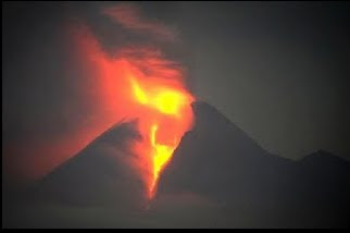
PROCESS OF volcano eruption

Volcanic eruption, magma caused by sediment in the bowels of the earth is pushed out by high-pressure gas. Of such eruptions of the volcano is formed. Eruptions of ash and rock that brought loud burst with radius as far as 18 km or more, being able to overwhelm the lava as far as 90 km radius. Volcanic eruptions can cause casualties and huge property to thousands of kilometers away and even bias affects the climate on earth is round. The results of volcanic eruptions (source: MPBI)

volcanic gas
Lava and flow of sand and hot rock
Lava
Landslide
Earthquake
Ash eruption
Hot clouds (pyroclastic)
Volcanic gases are gases released during volcanic eruptions that released carbon monoxide, among others, (CO), Carbondioksida (CO2), Hydrogen Sulfide (H2S), sulfur dioxide (SO2) and nitrogen (NO2) are dangerous to humans.

Lava is magma that high-temperature fluid flow to the surface through a volcanic crater. Liquid lava can flow away from the source follows the river or the valley while the thick lava flows not far from the source. Lava is one danger to society tingla on the slopes of the volcano. Is a flood of lava on the slopes Bandang consisting of a mixture of clay-sized material until volcanic boulders. Known as the lava eruptions and lava rain. Lava eruptions occur when a volcano that has erupted crater lake, so the lake water mixes with the hot material of the eruption, while the rain lava eruptions occur due to material mixing with rain water around the peak.
Hot clouds can form pyroclastic flows, pyroclastic blast and pyroclastic fall-out. Thermal cloud is a cloud of material flow eruption of hot, flowing down and finally settled in and around the river from the valley. Blowing hot cloud is a cloud of hot material a small eruption, blown by the wind speed reaches 90 km / h. Dropping the hot cloud is a cloud of hot material large and small eruption that was brought up by the power of a large eruption. Large material will fall around the peak, while the fine would fall in the tens, hundreds or even thousands of miles from the summit because of the influence of wind gusts. Hot clouds can cause burns to exposed body parts such as head, arms, neck or legs and also to not cause shortness of breath.


Volcanic ash is very fine material. Because the effects of wind can be felt hundreds of kilometers away. The impact of ash eruptions
Respiratory problems, vision problems, pollution of water sources, causing an electrical storm, disrupting work and motor vehicle engines, damaging the roof, damaging fields, damaging infrastructure. Preparations for Volcano Eruptions
identify local areas in determining a safe place to evacuate
disaster planning
prepare for evacuation if necessary
prepare the basic needs (food, clothing protective equipment)

In the event of Volcano Eruption
Avoid areas prone to disasters such as mountain slopes, canyons and lava flow area
In the open, protect themselves from ash and pyroclastic eruption
Prepare yourself for the possibility of follow-up disaster
Wear clothing that can protect the body, such as long sleeves, long pants, hats and other
Use eye protection such as goggles or other
Do not wear contact lenses
Wear a mask or cloth over the mouth and nose
Current pyroclastic fall try to cover her face with both hands.
In the aftermath of the Volcano Eruption
stay away from areas affected by ash falls
Clean the roof of Abu heap, because the weight can damage the ataun collapsed the roof of the building
Avoid driving in areas affected by ash fall because it can damage the engine, brakes, gears up to ignition.
This article comes from comic volcano, disaster prevention media created by IDEP Foundation with support from BAKORNAS PBP, CRS, MPBI, UNESCO, USAID and the people of Indonesia.

Geomorphology is the one piece of geography

Geomorphology is the one piece of geography. Where geomorphology which is a branch of geography, learning about the shape of the earth, which includes a broad view of the scope of the appearance of the landscape (landscape) to the smallest unit as a form of land (landform).
Landform system consists of mountains, hills, volcanic, karst, Alluvial, until the Marine Plain is formed by the influence of the constituent rocks at the bottom layer of the earth's surface.
Observation and identification of landforms such as is done directly in the field by conducting field trips or can also be done with the interpretation of aerial photographs or Landsat Analysis (ACS). Remote sensing as a tool to monitor or observe objects without touching biumi face it directly, among other form of aerial photography or satellite imagery.
Landscape will be easily identified by sight distance or if using aerial photography or satellite imagery using a small-scale images. In contrast to the landscape easily observed at close range or with aerial photos or satellite imagery with a larger scale.
By observation and analysis of aerial photographs of land forms will other biophysical information obtained both as a fixed parameter (landform, rock, soil, slope) and the parameter changes (erosion, terrace, land use).

By doing fieldtrip will be more well known in the field of land forms, making it easy to remember it if ever seen in person and as a basis for memory at the time of aerial photo interpretation (IFU).
Forms of land even though easily observed by aerial photographs, but the approach needs to be done by doing come directly to the field in the form of field trips (field trip). It is intended to further ensure tersiri landform forming elements of the composition or arrangement of any rocks. Besides, the survey will be acquired lapangna fotro interpretation of several key air (IFU) of the results of field visits to various different land forms. So that would be obtained with IFU key analaisis a more complete form of land which is a constituent component of the landscape.
Complex form of the earth has become a subject of its own, especially in business usage. In this case any land formations have different capacities in an effort to support the use of which would lead to appropriate. So with the same goal which is intended to simplify the form of a complex land surface of this earth, then the understanding of the science of geomorphology to study land formations are very important.
Simplification of the complex face of the earth form a unit which has a similarity in the nature and perwatakannya. Unitary properties include geological or geomorphological structure similarity as the origin of its formation, geomorphological processes as giving information on how the land is formed, and topographical impression that will provide information about the configuration of the land surface. Given the information is appropriate land use planning will be further realized.

Until now the literature and maps on geomorphology Indonesia is still very little.
Existing maps, the area is very limited and small scale. While the map is
are needed as basic data to support development planning
a region.
Indonesia is currently only available in small-scale geomorphological map, which geomorphological map
Java by Pannekoek (1946) in the scale 1: 1,000,000. Then Verstappen
(1973), produced a geomorphological map of the island of Sumatra and the islands of the
surrounding the use of research utilizing image inderaan uh ja
a scale of 1: 2,500,000.
Several agencies in Indonesia, lately has been trying to make a map
geomorphology, but the emphasis the problem is still around generation (relief)
the earth's surface, while the process of its formation has not been disclosed in detail.
Since 1989, Center for Geology has mapped the geomorphology
using System ITC in 16 regions. Mapping resulted in 16 pieces
geomorphological map of the whole has been published in the scale 1: 100,000 (15 pieces)
and scale 1: 50,000 (1 sheet).
Given the above, the standard preparation of maps Geomorphology
is structured to generate a standard geomorphological map (default). System (method)
compilation system of ITC (International Institute for Aerospace Survey and
Earth Sciences) with a reference book entitled "Aerial Photo-Interpretation in
Terrain Analysis and Geomorphologic Mapping "(Van Zuidam, 1985). ITC system
selected and used as reference considering this system is a combination of
some existing systems, both in tropical, sub tropical, dry and slightly dry.
In the preparation of maps of geomorphology, the use and appearance factors need to be
consider, among other things:
a. Can be used for various types of terrain and flexible.
b. Can be used dlam various ways.
c. Simple and informative.
Intent and purpose of standardizing the preparation of maps of geomorphology is as
guidance in preparing geomorphological maps in Indonesia.

Prepared taking into account aspects of the terminology is often used in
maps and has a very distinctive name arranged alphabetically.
Landscape (landscape)
scenery composed by geomorphological elements in dimension
a wider range of terrain.
Forms of land (landform)
physical complex surface or near surface of the land
influenced by human activities.
Formation origin (morphologic origin)
landscape formation based on the genesis (mulajadi).
Denudation (denudation)
the process of stripping the earth's surface of the lid.
Geomorphological elements (geomorphologic element)
the smallest piece of land that have the same shape and form
genesanya.
Erosion (erosion)
series of processes that lead to a number of earth or rock material
eroded, transported and relocated elsewhere in the earth's surface.
Fluvial (fluvial)
activities that cause stream erosion, transport and
deposition of material on the surface of the earth.
Style endogenous (endogenous force)
power comes from within the earth that caused the movement,
fault, and vulkanisma perlipatan in the earth's surface.
Style exogenous (exogenous force)
energy from the outside world which leads to changes in
surface or near the earth's surface, such as weathering, erosion, abrasion, denudation.
Geomorphology (geomorphology)
is the science of the earth and its novel aspects
influence it.
Hogbek (hogkback)
ridge of hills or mountains with sharp peaks formed by
rock layers are hard and steep slopes.
Kars (karst)
shape the landscape caused by the intensification of the process of dissolving rock
limestone to form a distinctive landscape.
Kuesta (Cuesta)
hill or mountain that has two different slopes. Surface
slope of the ramps in line with the bedding area while the slopes
steep cut the bedding area.
Marin (marine)
activity of sea water which can cause abrasion, transport and
deposition in the marine environment.
Mesa (mesa)
isolated hill or mountain-shaped table, with the rest of the denudation
layers of flat rock hard as the lid.
Morfodinamis (morphodynamics)
landscape forms are strongly associated with the work style of exogenous water,
wind, ice and ground motion, eg sand dunes, river terraces, coastal embankment,
critical lands (Badlands).
Morfoerasi (morphoerosion)
are various forms of erosion that can be used as a measure of the degree of degradation
landform of an area.
Morfogenesa (morphogenesis)
landscape forms are classified based on mulajadi (genetic)
and development of landforms and the processes that happen to him.
Morphology (morphology)
the study of the shape the earth's surface.
Morfokonservasi (morphoconservation)
preservation of natural land forms based on the parameters.
Morfokronologi (morphochronology)
ties variety of land forms and processes.
Morphometry (morphometry)
quantitative aspects of the geomorphology of an area, eg, slope steepness, height,
terrain roughness.
Morfografi (morphography)
diskriptik geomorphological aspects of an area, eg, plains, hills, mountains,
plateau.
Morfostruktur active (active morphostructure)
landscape forms are strongly associated with the work style of the endogenous
dynamic, including volcanoes, tectonic (folds and faults), eg volcanoes,
ridge anticline and fault escarpment.
Morfostruktur passive (passive morphostructure)
form a landscape that is classified on the basis of rock type and structure
rocks that are related to denudation, eg mesa, kuesta, hogbek, and
dome.
Weathering (weathering)
the destruction of rock or mineral surface of the earth become a more
small or soft because of the physics, chemistry and biology.
Sectional geomorphology (geomorphologic cross section)
was sliced ​​up that reflect the landform configuration
landscape.
Land cover (land cover)
Anything that covers the surface of the earth, either natural or artificial.
Terrain (terrain)
form of surface or near the earth's surface that have physical characteristics
particular.

The process of forming WINDS BEHIND THE BENEFITS AND TORNADO TORNADO DISASTER

Wind TORNADO!


What is a Tornado / Putting a pickaxe?


Does Putting Tornado with a pickaxe, he replied yes, the difference is only in reference to the scale and intensity of the Tornado, Tornado in Indonesia known as angina or angina leysus putting pickaxe, which is different is the scale of intensity only, in Indonesia a little tornado danger

What is a tornado?

According to the Dictionary of Meteorology (AMS 2000), a tornado is "a rotating column of air with a loud, arise from cumuliform cloud or from the bottom of cumuliform cloud, and often (not always) looks like a funnel cloud." In other words, a vortex is classified as a tornado, to be connected with the ground and the cloud base. Meteorology experts have not found an easy way to classify and define tornadoes. For example, there is no clear distinction between mesosiklon (parent thunderstorm circulation) on the surface with a large weak tornado. It is known that the tornado funnel is not visible. Also, at what speed of the cloud to the surface of the tornado started.
How Tornado Formed?
What is a Tornado / Putting a pickaxe?

Does Putting Tornado with a pickaxe, he replied yes, the difference is only in reference to the scale and intensity of the Tornado, Tornado in Indonesia known as angina or angina leysus putting pickaxe, which is different is the scale of intensity only, in Indonesia a little tornado danger

What is a tornado?

According to the Dictionary of Meteorology (AMS 2000), a tornado is "a rotating column of air with a loud, arise from cumuliform cloud or from the bottom of cumuliform cloud, and often (not always) looks like a funnel cloud." In other words, a vortex is classified as a tornado, to be connected with the ground and the cloud base. Meteorology experts have not found an easy way to classify and define tornadoes. For example, there is no clear distinction between mesosiklon (parent thunderstorm circulation) on the surface with a large weak tornado. It is known that the tornado funnel is not visible. Also, at what speed of the cloud to the surface of the tornado started.
How Tornado Formed?


Most of the destructive and deadly tornadoes caused by Supercell, which are rotating thunderstorms with a regular circulation called mesosiklon. Supercell also can cause a destructive hail, high winds non-tornado, lightning, and sudden floods. Tornado formation can generally be seen on the things that happen on the storm scale, in and around mesosiklon. Tornado-related growth differences in temperature at the edge of the air masses down (downdraft) around mesosiklon (occlusion downdraft). Mathematical modeling studies of tornadoes growth also indicates a tornado can happen without such temperature patterns; even the reality, the observed temperature variation is very small in some of the tornado that caused severe damage in their history, on May 3, 1999.
From which direction a tornado comes?


· Can terjad anytime each year
· It can happen anywhere around the place in the world, but in the high latitude regions terjdinya usually in spring or summer
· In the United tornadoes can occur at 15 to 21 LT
· In Indonesia more bayank around Sumatra and Java (see table tornado frequency)

Does hail always happens before a tornado? Rain? Express?

Characteristics of rain, wind, lightning, and hail by observer varies from storm to storm one another, from hour to hour, and even the direction of movement of the storm. Large hail can indicate thunderstorms are not uncommon, and may occur before the tornado. Hail, or any other form of precipitation, lightning is not exactly going to happen tornado prediction.
Types of Tornadoes
Weak Tornado
Covers 88% of the total tornado
Cause of death is less than 5%
Have a grace period 1s.d> 10 min
Wind speeds less than 110 mph

Strong tornado
Covers 11% of the total incidence of tornadoes
Causing the death of nearly 30%
Has a duration of 20 minutes or even more
Have wind speeds of 205 mph 110 s.d


Tornado is very strong
Includes 1% of the total number of tornado events
Causing the death of nearly 70%
Have a duration exceeding 1 hour
Have wind speeds> 205 mph


How long lived tornado?
Tornadoes can last from a few seconds to over an hour. Most of the tornadoes last less than 10 minutes.

Benefits Tornado
Apparently behind dasyatnya tornado tornado saving benefit:
-Keep the temperature of the area through which the tornado. . . that the area is not too cold / hot because of the tornado brought winds of Regional else. . . which is usually from colder regions, more heat from the area hit by the wind
maybe if there is not much of a tornado into a desert and steppe Ice
many Latin American countries such as the desert due to no tornado

many countries like the United States into the field because there is no tornado Ice

Conclusion
- In Indonesia the term is called Tornado Wind Putting the wind picks or quail / captured or angina also Leysus
- The frequency of tornado occurrence in Putting out 2006 in Sumatra and Java are more frequent in November during the rainy season and into March when entering the dry season.
- Genesis hurricane or tornado winds Putting more often in the afternoon or evening

GIS FOR GLOBAL WARNING

Global Warming is the increase of temperature average of the atmosphere, ocean and land earth. Global average temperature at Earth's surface has risen 0:18 Â ° C over the last hundred years. Intergovernmental Panel on Climate Change (IPCC) concluded that, "most of the increase in global average temperatures since the mid-20th century is most likely caused by increased concentrations of greenhouse gases due to human activity through the greenhouse effect.
Increasing global temperatures are expected to lead to other changes such as rising sea levels, increased intensity of extreme weather events, as well as changes in the number and pattern of precipitation. Consequences of global warming is terpengaruhnya other crops, the loss of glaciers and the extinction of various animal species. Most of the governments of countries in the world have signed and ratified the Kyoto Protocol, which leads to the reduction of emissions of greenhouse gases.
Some of the causes of global warming or Global Warming
A. The greenhouse effect
All energy sources that exist on Earth comes from the Sun. Most of the energy in the form of short-wave radiation, including visible light. When this energy on Earth's surface, he turned from the light into heat that warms the Earth. Earth's surface, will absorb some heat and reflecting back the rest. Much of this heat as long-wave infrared radiation into space. But some of the heat remains trapped in Earth's atmosphere due to accumulated amount of greenhouse gases such as water vapor, carbon dioxide, and methane which trap this radiation. These gases absorb and reflect radiation emitted waves of the earth and consequently heat is stored in the Earth's surface. This happens over and over and result in annual average temperature of the earth continues to increase. Gases serve as the glass in a greenhouse. With the increasing concentration of these gases in the earth, the more heat is trapped underneath. Actually, the greenhouse effect is needed by all living things on earth, because without it, the planet will be very cold. So the ice will cover the entire surface of the Earth. However, due to the amount of these gases has been excess in the atmosphere, global warming are the result.

2.Efek feedback
The effects of global warming-causing agents is also influenced by various feedback processes that result. An example is the evaporation of water. In the case of warming due to increasing greenhouse gases such as CO2, warming will initially lead to more amount of water that evaporates into the atmosphere. Because water vapor is itself a greenhouse gas, warming will continue and increase the amount of water vapor in the air to reach an equilibrium concentration of water vapor. The resulting greenhouse effect is greater than the effect of CO2 alone. (Although this feedback increases the absolute water content in the air, relative humidity of air is almost constant or even decreases slightly because the air becomes warmer). This feedback can only be reversed slowly as CO2 has a long age in the atmosphere.
Feedback effects due to the influence of clouds is the object of current research. When viewed from below, clouds will reflect infrared radiation back to the surface, thereby increasing the heating effect. In contrast when viewed from above, clouds will reflect sunlight and infrared radiation to space, thereby increasing the cooling effect. Whether the net effect heating or cooling depending on some specific details such as the type and height of these clouds. These details are difficult to be represented in climate models, partly because the clouds are very small compared to the distance between the boundaries of computational climate models (about 125 to 500 km to the model used in the Fourth Report of the IPCC view
Another important feedback is the loss of the ability to reflect light (albedo) by es.Ketika global temperatures increase, ice near the poles melts at an ever increasing. Together with the melting of the ice, land or water below will open. Both land and water has the ability to reflect light much less when compared to the ice, and consequently will absorb more solar radiation. This will increase the heating and causing even more ice melts, it becomes a continuous cycle.
Positive feedback due to release of CO2 and CH4 from the softening of frozen ground (permafrost) are other mechanisms that contribute to warming. In addition, the melting ice will also cause release of CH4 are also positive feedback.
The ability of oceans to absorb carbon will also be reduced if it warms up, this is caused by a decline in nutrient levels in the zone and limit the growth of diatoms Mesopelagic than phytoplankton is low carbon sinks.
3.Variasi Sun
There is a hypothesis which states that the variation of the Sun, with a possibility reinforced by feedback from the clouds, can contribute to warming. Difference between the heating mechanism is due to the greenhouse effect is the increased activity of the Sun would heat the stratosphere reverse the greenhouse effect cools the stratosphere. Cooling the lower stratosphere has been observed since at least 1960, which will not occur when the solar activity to be a major contributor to recent warming. (Depletion of the ozone layer may also provide the cooling effect, but depletion occurred from late 1970's.) The phenomenon of solar variability combined with volcanic activity may have provided the warming effect from pre-industrial times to 1950, as well as a cooling effect since 1950 .
Impact of Global Warming
A. Weather
Scientists predict that during global warming, the northern part of the Northern Hemisphere (Northern Hemisphere) will heat up more than other regions on Earth. Consequently, the icebergs will melt and the land will shrink. Will be less ice will float on northern oceans. Areas that previously experienced mild snow, probably will not experience it again. In the mountains in temperate regions, the snow-covered will be less and will melt faster. Growing season will be longer in some areas. Temperatures in winter and at night would tend to increase. Warmer regions will become more humid as more water evaporates from the ocean. Scientists are not quite sure whether the humidity will actually increase or decrease the warming even further. This is because water vapor is a greenhouse gas, so its presence will increase the insulation effect on the atmosphere. However, more water vapor will also form more clouds, so it would reflect sunlight back into space, where it will reduce the heating process (see the water cycle). High humidity will increase rainfall, on average, about 1 percent for every degree Fahrenheit of warming. (Rainfall in the world has increased by 1 percent in the last hundred years). Storms will become more frequent. In addition, the water will evaporate more quickly from the ground. As a result, some areas will become drier than before. The winds blow harder and perhaps with a different pattern. Typhoon (hurricane) which draws its strength from the evaporation of water, will become larger. Contrary to the warming that occurred, some very cold periods may occur. Weather patterns become more extreme and unpredictable.
2. Sea level
Changes in average height is measured from sea level to the area geologically stable environment. As the atmosphere warms, the surface layer of the oceans will also warm, so the volume will expand and raise the sea level. Warming will also melt much glacier ice, especially around Greenland, which further increase the volume of water in the ocean. Sea levels worldwide rose 10-25 cm (4-10 inches) during the 20th century, and IPCC scientists predict a further rise of 9-88 cm (4-35 inches) in the 21st century. Changes in sea levels will profoundly affect the lives in coastal areas. Increase of 100 cm (40 inches) would submerge 6 percent of the Netherlands, 17.5 percent of the Bangladesh, and many islands. Erosion of cliffs, beaches and dunes will increase. When the high seas reach estuaries, tidal flooding due to increase in the mainland. Rich countries will spend huge funds to protect coastal areas, while poor countries may only be able to evacuate from the area pantai.Bahkan little sea level rise will affect coastal ecosystems. Increase of 50 cm (20 inches) would submerge half of coastal marshes in the United States. New marshes will also be formed, but not in urban areas and areas that have been built. This sea level rise will cover much of the Florida Everglades.
3. Agriculture
One might assume that a warmer Earth will produce more food than ever before, but it is actually not the same in several places. Southern parts of Canada, for example, may benefit from the higher rainfall and better growing season length. On the other hand, the semiarid tropical farmlands in some parts of Africa may not be able to grow. Desert farm regions that use irrigation water from distant mountains may suffer if the snowpack (snow collection) winter, which serves as a natural reservoir, would melt before the peak growing season months. Crop and forest insect and can experience a more severe disease.
4. Animals and plants
Animals and plants are living things that are difficult to avoid the effects of warming because most of the land has been controlled by humans. In global warming, animals tend to migrate toward the poles and up mountains. Plants will change the direction of growth, looking for new areas as old habitats grow too warm. However, human development will impede this movement. Species migrate north or south is blocked by the cities or agricultural lands may be dead. Several types of species that are not able to rapidly move toward the poles may also be destroyed.
5. Human health
In a world of warm, scientists predict that more people will get sick or die from heat stress. Diseases that are commonly found in tropical areas, such as diseases caused by mosquitoes and other disease-carrying animals, will widen as they move into regions formerly too cold for them. Currently, 45 percent of world population lives in areas where they might get bitten by mosquitoes carrying the malaria parasite; that percentage will increase to 60 percent if temperatures rise. Other tropical diseases may spread like malaria, such as dengue fever, yellow fever, and encephalitis. Scientists also predict rising incidence of allergies and respiratory diseases as warmer air charged with pollutants, mold spores and pollen.
Control of global warming solutions
Total consumption of fossil fuels in the world is increasing. Steps taken or are being discussed at this time no one can prevent global warming in the future. The current challenge is to overcome the effects that arise while taking steps to prevent the changing climate in the future. Severe damage can be overcome in various ways. Coastal areas can be protected by walls and barriers to prevent entry of sea water. Alternatively, the government can help the population in coastal areas to move to higher ground. Some countries, such as the United States, can save plants and animals while maintaining the corridor (line) habitat, clear the land that has not been built from south to north. Species can move slowly along the corridor is to go to a cooler habitat.
There are two main approaches to slow the increase in greenhouse gases.

1.Menghilangkan carbon
The easiest way to remove carbon dioxide in the air is to maintain trees and plant more trees. Trees, especially the young and fast growing, very much to absorb carbon dioxide, break through photosynthesis and store carbon in wood. Around the world, the rate of forest encroachment has reached an alarming level. Measures to combat this is with the role of reforestation in reducing the increasing greenhouse gases. Carbon dioxide gas can also be removed immediately. You do this by injecting (injecting) the gas into oil wells to push the oil out to the surface (see Enhanced Oil Recovery). Injection can also be made to isolate it in underground gas as in oil wells, coal seams or aquifers. This has been done in one of Norway's offshore drilling rig, in which carbon dioxide is brought to the surface with natural gas is captured and injected back into the aquifer so it can not go back to the surface.
One source contributor of carbon dioxide is the burning of fossil fuels. At that time, coal became the dominant energy source for later replaced by oil in the mid-19th century. In the 20th century, began regular gas energy used worldwide as an energy source. Change of trend in the use of fossil fuels is actually indirectly have reduced the amount of carbon dioxide released into the air, because the gas release less carbon dioxide compared to oil especially when compared with coal. However, the use of renewable energy and nuclear energy further reduces the release of carbon dioxide into the air. Nuclear energy, although controversial for reasons of safety and hazardous wastes, did not even release carbon dioxide at all.
International

2.Agreetmen
International cooperation is needed to succeed in reducing greenhouse gases. In 1992, the Earth Summit in Rio de Janeiro, Brazil, 150 countries pledged to confront the problem of greenhouse gases and agreed to translate this intent in a binding contract. In 1997 in Japan, 160 countries to formulate a stronger agreement known as the Kyoto Protocol.
This agreement, which has not been implemented, calls for 38 industrialized countries that hold the greatest percentage in the release of greenhouse gases to cut their emissions to levels 5 percent below 1990 emission. This reduction must be achieved no later than 2012. At first, the United States volunteered to do a more ambitious cuts, promising to reduce emissions by 7 percent below 1990 levels; the European Union, which wants a tougher treaty, committed 8 percent and Japan 6 percent. The remaining 122 other countries, most developing countries, are not required to commit to the reduction of gas emissions.
However, in 2001, the new U.S. president-elect, George W. Bush announced that an agreement for the reduction of carbon dioxide is a very large cost. He also denied the claim that developing countries are not burdened with it carbon dioxide reduction requirements. Kyoto Protocol does not affect anything if the industrialized countries are responsible accounted for 55 percent of greenhouse gas emissions in 1990 did not ratify it. It successfully met the requirements as of 2004, Russian President Vladimir Putin ratified this agreement, provide an avenue for entry into force of this agreement began February 16, 2005.
Many people criticized the Kyoto Protocol too weak. Even if the agreement is implemented immediately, it will only slightly reduce the increased concentration of greenhouse gases in the atmosphere. A harsh measures will be needed later on, especially as developing countries are excluded from this agreement will result in half of the greenhouse gas emissions by 2035. Opponents of this protocol has a very strong position. The rejection of this treaty in the United States primarily raised by the oil industry, coal industry and other companies whose production depends on fossil fuels. Opponents claim that the economic costs required to implement the Kyoto Protocol can menjapai 300 billion U.S. dollars, mainly due to energy costs. Instead the Kyoto Protocol supporters believe that the only cost required by 88 billion U.S. dollars and may be more or less again, and returned in the form of saving money after the change to the equipment, vehicles, and industrial processes more efficient. In a country with strict environmental policy, the economy can continue to grow despite various kinds of pollution have been reduced. However, to limit emissions of carbon dioxide proved to be difficult.
For example, the Netherlands, the big industrialists are also pioneers of the environment, has successfully overcome various kinds of pollution but failed to meet its target in reducing the production karbondioksida.Setelah 1997, the representatives of the signatories of the Kyoto Protocol met regularly to negotiate issues unresolved such as rules, methods and penalties that must be applied to any country to slow greenhouse gas emissions. Negotiators designing the system in which a country that has a successful cleaning program can take advantage by selling unused pollution rights to other countries. This system is called carbon trading. For example, state that the results are difficult to increase again, like the Netherlands, could buy pollution credits on the market, which can be obtained with a lower cost. Russia, the countries benefiting when the system is implemented. In 1990, the Russian economy is lousy and greenhouse gas emissions is very high. Because then the Russians managed to cut its emissions by more than 5 percent below 1990 levels, he is in a position to sell emission credits to other industrial countries, especially those in the European Union.
Global Warming is a history of the worst experienced by the earth since the inception to the present.
Some other ways to reduce and prevent the effects of Global Warming:
Energy frugality. As in the use of fuel oil, electricity (do not use electronic devices when not obvious needs).
Using a motor vehicle as needed. If it were just close, no need to use a motorcycle or car.
Reduce arson. For example, the burning of garbage, avoid forest fires.
Reforestation
Avoid the use of redundant goods
For marine ecosystems, avoid destruction of corals and fish by destructive searching (the use of bombs or the like)