I'm trying to make a mini tutorial to answer the question.
Plus the first How to use the ArcGIS 3D Analyst extension. Layercontours in shp format first converted into 3D using the facilities available in 3D Analyst. Then the result (the default file name itsdddfeat1.shp) imported from AutoCAD (Map). Here are the stages of the process is accompanied with a screenshot:
3D Analyst -> Convert Features to 3D
From DXF Export Options window that opens, make sure you check the option 'Create a 3D Feature Loaded Using Elevation Data'.Click OK, save the file name you want.
You now have a 3D file format that can open dxf in AutoCADprogram.
Have an alternative way of doing the conversion layer contours of the format ESRI shapefile (shp) into CAD layer with a fixed value ofz to obtain his or elevation of the contour? Please share yourknowledge by filling in the comment below.
Plus the first How to use the ArcGIS 3D Analyst extension. Layercontours in shp format first converted into 3D using the facilities available in 3D Analyst. Then the result (the default file name itsdddfeat1.shp) imported from AutoCAD (Map). Here are the stages of the process is accompanied with a screenshot:
3D Analyst -> Convert Features to 3D
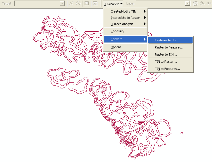
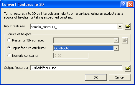
- Determine the features of his input, and define the source ofheights. The value of the layer elevation contour shp file formatscontained in the attribute, for that select the input feature attributeselect field name that has the elevation value. By default the filename conversion result is dddfeat1.shp.
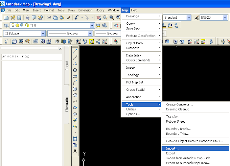
- File conversion results (dddfeat1.shp) then imported in the CAD program. Open AutoCAD (Map), from the Map menu -> Tools ->Import
- From the Import window that opens, navigate to the drive / folderwhere the files are stored dddfeat1.shp. Make sure the Files of typeis ESRI Shape. Click OK
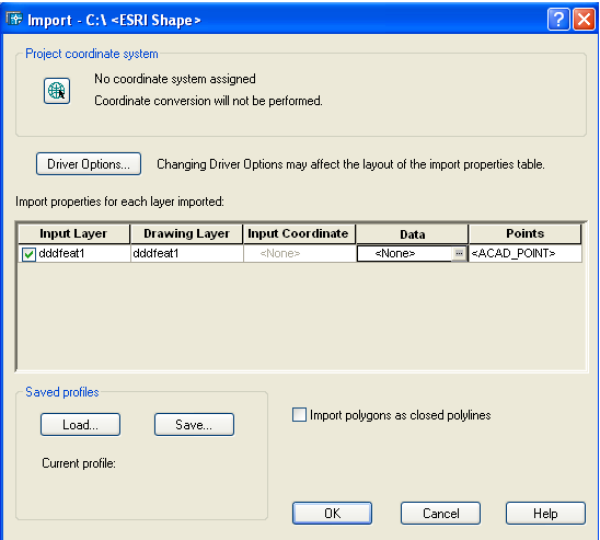
- See the picture above, click on the words <None> the Data column.You will fill in the resource value of elevation at the open window as shown below. Select Create Data Object, and click the SelectFields.
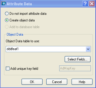
- On Mapping Data Object window as shown below, select the fieldsthat will be used as input. Click OK
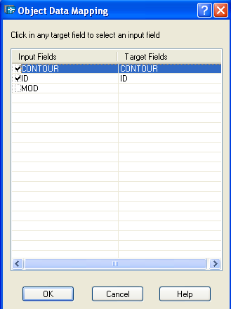
- Zoom to Extents to see the contours of the converted. To see theelevation contours, select one of the contour line, see its properties(right click).
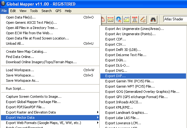
The second way, is much more simple, by using the Global Mappersoftware. Open the file in a format shp contour, then from the File menu -> Export Vector Data-> Export DXF.
 |
 |
Have an alternative way of doing the conversion layer contours of the format ESRI shapefile (shp) into CAD layer with a fixed value ofz to obtain his or elevation of the contour? Please share yourknowledge by filling in the comment below.


