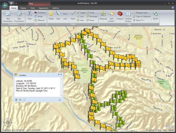
With the new capabilities of ArcGIS Explorer Desktop Build 1700, users can do with ArcGIS Explorer GPS tracking as a visualizationeither in static conditions or while moving (mobile). Users can alsoquery on the shapes of existing data (points, lines, areas) usingspatial operators such as contains, intersects, Overlaps, and within.
Though GIS is not a long blog post images to GIS using ArcGISExplorer and Mini GIS Tutorial: Using GPS Data to ArcMapDesktop ArcGIS Explorer is of course using Build 1500. I'll try toupdate the tutorial with the latest version Build 1700 of this another time.
Though GIS is not a long blog post images to GIS using ArcGISExplorer and Mini GIS Tutorial: Using GPS Data to ArcMapDesktop ArcGIS Explorer is of course using Build 1500. I'll try toupdate the tutorial with the latest version Build 1700 of this another time.