ArcGIS can be used to visualize the form of 3-dimensional (3D) wells drilled, the lower surface of the soil / geological cross-section of a shapefile with well log data, in which there are well locations (wells) in the x and y coordinates as well as geological formations in the value of z.
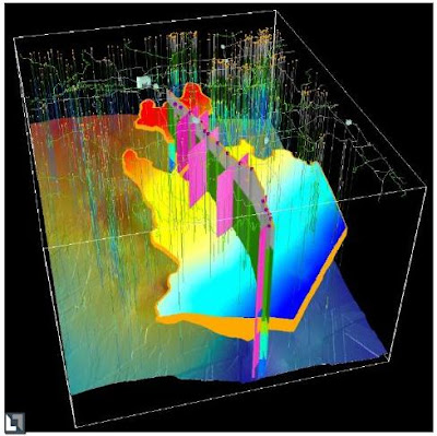
Link at the end of this post will show you step by step guidance in a 43 page ebook formats, instructions for mapping the 3D surface modeling using the ArcGIS underground geological and well log data. ArcGIS components are required in addition to ArcScene and ArcCatalog ArcMap. Besides the 3D Analyst extension is required, Spatial Analyst and XTools Pro for ArcGIS.
Previously I've posted a tool to create a geological cross section in ArcGIS. The program is named geologic Create an exacto Section Cross-Sections